RB Issarles

ARPF
User

Length
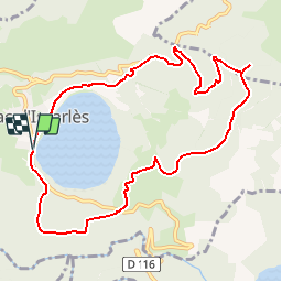
10.3 km

Max alt
1337 m

Uphill gradient
402 m
Km-Effort
15.6 km

Min alt
999 m

Downhill gradient
405 m
Boucle
Yes
Creation date :
2014-12-10 00:00:00.0
Updated on :
2014-12-10 00:00:00.0
3h19
Difficulty : Medium

FREE GPS app for hiking
 SityTrail
IGN / Geographical institutes
SityTrail Plus
The world is yours!
About
Trail Walking of 10.3 km to be discovered at Auvergne-Rhône-Alpes, Ardèche, Le Lac-d'Issarlès. This trail is proposed by ARPF.
Description
09/06/14 Robert
Positioning
Country:
France
Region :
Auvergne-Rhône-Alpes
Department/Province :
Ardèche
Municipality :
Le Lac-d'Issarlès
Location:
Unknown
Start:(Dec)
Start:(UTM)
584085 ; 4963157 (31T) N.
Comments